



 Add
AddAir quality in Roseville
Air quality index (AQI⁺) and PM2.5 air pollution in Roseville • 145.6K Followers • 17:00, Sep 30
61
US AQI⁺Moderate

Main pollutant:
O₃
114 µg/m³

33°

3 km/h

20 %
Hourly forecast
Roseville air quality index (AQI⁺) forecast


Daily forecast
Roseville air quality index (AQI⁺) forecast
| Today | 55 |  | 36° 20° |  5 km/h | 26% |
| Thu | 60 |  | 36° 21° | 6 km/h | 25% |
| Fri | 65 | | 37° 21° | 7 km/h | 16% |
Air pollutants
What is the current air quality in Roseville?

PM2.5 concentration is currently 1.3 times the World Health Organization annual PM2.5 guideline value.
Health recommendations
 Sensitive groups should reduce outdoor exercise |
 Close your windows to avoid dirty outdoor air Get a monitor |
 Sensitive groups should wear a mask outdoors Get a mask |
 Sensitive groups should run an air purifier Get an air purifier |



Pollen
What is the pollen count in Roseville today?
Index

Moderate
 Tree None | 0% |
 Grass None | 0% |
 Weed Moderate | 50% |
Source:
wetter.comHealth recommendations
Sensitive groups should reduce outdoor exercise |
Close your windows to avoid dirty outdoor air Get a monitor |
Sensitive groups should wear a mask outdoors Get a mask |
Sensitive groups should run an air purifier Get an air purifier |
Pollen
What is the pollen count in Roseville today?
Index
Moderate
Tree None | 0% |
Grass None | 0% |
Weed Moderate | 50% |
Source:
wetter.comMost polluted locations near Roseville
Worldwide AQI⁺ ranking
Station ranking
Real-time AQI⁺ station ranking for stations in Roseville

City ranking
Real-time USA AQI⁺ city ranking
Historic air quality near Roseville
History
Historic air quality graph for Roseville
Historic air quality near Roseville
History
Historic air quality graph for Roseville
Clean Air Facilities
Most polluted locations near Roseville
Worldwide AQI⁺ rankingStation ranking
Real-time AQI⁺ station ranking for stations in Roseville
City ranking
Real-time USA AQI⁺ city ranking



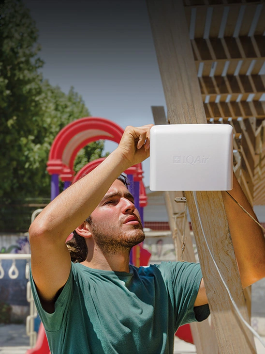
Measure your own air quality
Get a monitor and contribute air quality data in your city.


Learn more about air pollution in Roseville
What is the current air quality in Roseville?
The current air quality in Roseville is considered moderate. Air quality is acceptable for most people, though sensitive individuals may experience mild symptoms such as coughing or shortness of breath.
What is the air quality in Roseville, CA?
Roseville is a large suburb of Sacramento, the capital of the state of California, and the largest city in Placer County.
Roseville’s air quality is generally considered “good” according to the Air Quality Index (AQI) measurement used by the United States Environmental Protection Agency (EPA). This means that common air pollutants like particulate matter, ozone, and others do not build up to high enough concentrations in ambient air to exceed an AQI of 50 on an annual average basis. However, it’s worth noting that even air quality deemed “good” may still pose some health risks over time, as no amount of air pollution can truly be considered safe.
Roseville’s air quality also generally meets more stringent air quality guidelines from the World Health Organization, with average annual fine particulate matter pollution (PM2.5) remaining below 10 µg/m3. Roseville met this guideline in both 2017 (7.4 µg/m3) and 2019 (7.6 µg/m3).
Roseville did not meet this guideline in 2018 (11.4 µg/m3) or 2020 (12.9 µg/m3) because of especially severe wildfire seasons in Northern California.
Smoke from numerous fires during November 2018 as well as August-September 2020 caused poor air quality in Roseville and the greater Sacramento metropolitan area for days at a time. On September 14, 2020, Roseville’s PM2.5 concentration reached an all-time daily high of 166.6 µg/m3.
Why is Roseville, CA air quality so bad?
Several major factors can cause Roseville air pollution levels to fluctuate drastically on a daily basis or during periods when temporary sources of air pollution become severe or concentrated.
With a population of approximately 141,500, Roseville’s sizable residential population as well as those who commute in and out of the city each day for work and recreation significantly impact daily air quality levels.1
Exhaust from gas-powered vehicles, which contains toxic pollutants like particulate matter, sulfur dioxide (SO2) and carbon monoxide (CO), can rise to high levels during morning and evening rush hour traffic from 6 a.m. to 9 a.m. and from 4 p.m. to 7 p.m. Levels of traffic pollutants are especially high close to the two major highways that run through the city – Interstate 80 (I-80) and State Route 65 (SR65), the former of which feeds commuter traffic into nearby Sacramento.
A 2007 report by Breathe California also found elevated levels of particulate matter near the JR Davis Rail Yard, which has been in operation since 1905, due to diesel pollution from locomotive activity.2 The report found that the rail yard contributed about 25 tons of PM from diesel emissions in 2000 alone.
Heat from sunlight can react with pollutants from vehicle and locomotive emissions, generating ground-level ozone (O3) that results in a haze associated with smog. Breathing ozone can cause health effects like shortness of breath, dizziness, and confusion as well as contribute to respiratory disease, such as asthma. With a hot-summer Mediterranean climate, Roseville’s warm temperatures throughout the year increase the risk of ozone generation during hot days, as ozone is more likely to form when ambient temperatures rise above 84°F (about 29°C).
Roseville’s geography also contributes to the duration that air pollution lingers. Located far inland in the northern end of California’s Central Valley, the bowl-like topography of the Sacramento Valley surrounding Roseville can cause air pollutants to become trapped, resulting in pollution accumulations and rising concentrations.
Temperature inversions, when cold air at ground level becomes trapped by warm air higher in the atmosphere, can also trap pollutants for extended periods. These inversions are most common during days with high daytime temperatures and low nighttime temperatures, particularly during the summer months when temperatures can range from 50°F to as high as 100°F in a single 24-hour period.
Why is it so smoky in Roseville, CA?
Wildfires have been the primary source of poor air quality in Roseville and California as a whole during recent history.
In 2018, California experienced one of the most deadly and costly wildfire seasons in the state’s history. 103 people died and over $26 billion USD was incurred in property damage and costs to support firefighting efforts. Nearly 60 individual fires grew to over 1,000 acres, with the Mendocino Complex fires in far northern California alone burning nearly half a million acres.
Air pollution in Roseville also drastically spiked due to wildfire smoke from the nearby Camp Fire in 2018. From November 11-20, the daily average AQI remained well above 100, with an average AQI of 152 across this nearly 10-day period. The 2018 IQAir World Air Quality Report also noted high average annual PM2.5 levels in many cities near Roseville, with almost all of the top 15 most polluted cities in the U.S. that year, such as Stockton and Paradise, experiencing the same extreme smoke pollution during the California wildfire season.
After a relatively uneventful year for wildfires in 2019, Roseville again experienced severe air pollution from wildfires in September 2020. The 2020 wildfire season was less deadly and costly than the 2018 season. But wildfires and their toxic smoke broke records in the amount of acreage burned and the distance traveled by wildfire smoke, with particles from California wildfire smoke detected as far away as western Europe.3
From late August to mid-September, wildfire smoke from numerous fires in Northern California resulted in dangerously high air pollution levels, peaking at an AQI of 217 on September 14. From August 20 until September 22, the average AQI was roughly 113, well into the “unhealthy for sensitive groups” category for over a month.
Residential wood burning is also a major contributor to Roseville air pollution, especially during colder winter months when stoves, fireplaces, and other wood-fueled sources of heat are in greater use. In 2020 and 2021, smoke from household wood-burning contributed to numerous days of elevated PM2.5 and other smoke pollutants, reaching a peak average daily AQI of 77 in mid-January during both years.
How does Roseville, CA air quality compare to Sacramento, CA air quality?
Roseville air quality is generally better than Sacramento air quality on an annual basis.
Below is a comparison of the yearly average concentrations of PM2.5 during 2017-2020 for both cities.
- Roseville 2017: 7.4 µg/m3 (31 AQI)
- Sacramento 2017: 11.5 µg/m3 (48 AQI)
- Roseville 2018: 11.4 µg/m3 (48 AQI)
- Sacramento 2018: 14.7 µg/m3 (56 AQI)
- Roseville 2019: 7.6 µg/m3 (32 AQI)
- Sacramento 2019: 8.7 µg/m3 (36 AQI)
- Roseville 2020: 12.9 µg/m3 (53 AQI)
- Sacramento 2020: 12.9 µg/m3 (53 AQI)
Roseville air quality is typically better than Sacramento air quality due to Roseville’s relatively smaller population and lower population density. As a dense urban area and destination for work and recreation, the impact from daily commuter traffic is much greater in Sacramento than in Roseville.
Roseville also experiences more precipitation each year, with a yearly average rainfall of 20.45 inches, while Sacramento has about 17.42 inches of rain each year. Rainfall can help disperse air pollution as airborne pollutants coagulate with raindrops and are removed from the atmosphere.
Is air quality in Roseville improving?
In 2017, former California governor Jerry Brown signed AB617 into state law, which proposed the development and enforcement of a new program meant to involve communities throughout the state in identifying and mitigating the sources of vehicular air pollution.4 In Roseville, the Sacramento Metropolitan Air Quality Management District has been the primary authority responsible for developing and implementing this program.
The city of Roseville also has an official department known as the Alternative Transportation Division, whose purpose is to encourage Roseville residents to substitute or supplement travel by gas-powered vehicles with other, cleaner modes of transport, such as:5
- taking buses or trains
- riding bicycles for local trips
- use carpool or vanpools where available
- reducing unnecessary trips in gas-powered vehicles
- upgrade to a vehicle powered by alternative fuels, such as electricity or hydrogen
The state of California and the California Air Resources Board (CARB) has also collaborated to approve legislation requiring that all new vehicles sold in California be zero-emissions by 2035.6 Furthermore, the state has set ambitious goals to be completely carbon-neutral by 2045.
These ambitious goals will be costly but necessary. A 2020 report by the Center for Biological Diversity found that the state’s air quality would benefit significantly more by transitioning to zero-emissions vehicle sales by 2030, as transitioning five years earlier would reduce carbon dioxide (CO2) emissions over the next 25 years by 256 million tons by removing an additional 10.6 million gas-powered cars from California roads.7 Zero-emission vehicles would also cut concentrations of nitrogen dioxide (NO2), volatile organic compounds (VOCs), ozone, and PM2.5 air pollution.
+ Article Resources
[1] U.S. Census Bureau. (2019). QuickFacts: Roseville city, California population estimates.
[2] Breathe California. (2007). Our changing air: An overview of the risks to Placer County residents.
[3] Copernicus Atmospheric Monitoring Service. (2020, September 16). CAMS monitors smoke release from devastating US wildfires. European Centre for Medium-Range Weather Forecasts.
[4] AB-617 Nonvehicular air pollution: Criteria air pollutants and toxic air contaminants. (2017, July 26). California Legislative Information.
[5] City of Roseville, California. (n.d.). Alternative Transportation.
[6] Office of Governor Gavin Newsom. (2020, September 23). Governor Newsom announces California will phase out gasoline-powered cars & drastically reduce demand for fossil fuel in California’s fight against climate change. State of California.
[7] Center for Biological Diversity. (2020). All-electric drive: How California’s climate success depends on zero-emission vehicles.





