Air quality in Victoria
Air quality index (AQI⁺) and PM2.5 air pollution in Victoria • 04:28, Oct 22

Live most polluted city ranking
Real-time Victoria most polluted city ranking

Wildfires in Victoria
Real-time information

Active fires
--


Learn more about global air quality


Learn more about air pollution in Victoria
How bad is the air quality in Victoria?
Like much of Australia, the state of Victoria experiences relatively healthy air quality during most of the year in comparison with other global countries. However, Victoria air quality is also vulnerable to experiencing short-term extreme air pollution events, such as wildfires and dust storms, which can temporarily cause the state to experience extremely poor air quality, causing a range of environmental and health effects.
The main pollutants of concern to human health in Victoria are particulate matter, tiny airborne particles measuring below 10 microns or 2.5 microns in diameter (abbreviated as PM10 and PM2.5 respectively), and ozone.1 Fine particulate matter (PM2.5) is particularly hazardous for human health, since its microscopic size enables these particles to travel deep into the human system when inhaled, even entering the human bloodstream, causing a range of health effects.
During 2019, all 14 cities within Victoria which were measured in IQAir’s 2019 World Air Quality Report averaged an annual PM2.5 concentration within the World Health Organisation’s recommended annual mean target, of 10 μg/m3.2 However, 3 locations exceeded Australia’s own national PM2.5 target, which is slightly stricter at 8 μg/m3. The most polluted location in Victoria for PM2.5 pollution in 2019 was the town of Churchill (9.5 μg/m3), Traralgon (9.2 μg/m3) and Moe (8.6 μg/m3). All three of these locations experienced particularly high levels of PM2.5 pollution during the month of March 2019 (Churchill, 15.8 μg/m3; Traralgon, 13.7 μg/m3; and Moe 15.5 μg/m3), which may be attributed to the wildfire episode which occurred east of Victoria, nearby these towns during that time. These fires were triggered by lightning strikes across the state, significantly affecting the Bunyip state park around 65 kilometres east of Melbourne, and generating significant smoke which negatively affected Victoria air quality.
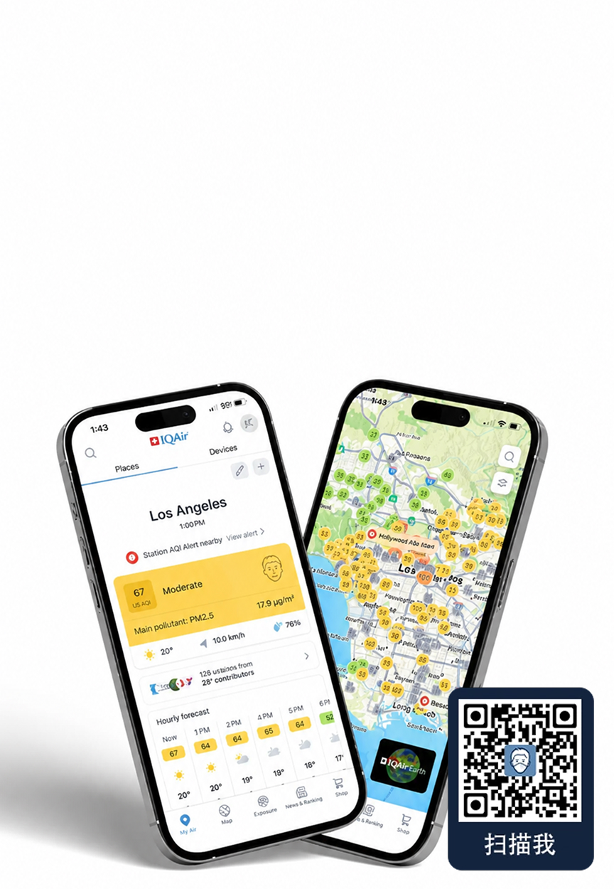
Real-time Victoria air pollution information can be viewed within the dynamic Victoria air quality map at the top of this page, which also includes live wildfire updates. These readings, along with a 7-day Victoria air quality forecast can also be followed on-the-go using the IQAir AirVisual air pollution app.
What are the health impacts of Victoria air pollution?
Exposure to common air pollutants can aggravate existing respiratory and cardiovascular conditions, and also increase the risk of developing new respiratory and cardiovascular conditions, such as lung cancer, chronic obstructive pulmonary disease (COPD), and increased risk of premature mortality and death. Certain parts of Victoria’s population are more vulnerable to the health impacts of air pollution, such as children, the elderly, and those with pre-existing health conditions.
Although Victoria air pollution is relatively low in comparison with other global regions, exposure to any level of air pollution can have significant health impacts, and Victoria is no exception to this. A study by Victoria’s Department of Environment, Land, Water and Planning (DELWP) found that the health burden of air pollution generated from only two specific sectors within Victoria contributed towards an annual cost of up to $2.1 billion AUD (equivalent to approximately $1.53 billion USD). These polluting activities were air pollution from the electricity sector (costing around $420 to $600 million AUD, or ~$307 to $438 million USD), and air pollution generated from transport (costing around $660 million to $1.5 billion AUD, or $482 million to $1.1 billion USD).3
What are the main sources of Victoria air pollution?
Victoria air pollution is generated from a range of sources, both anthropogenic (additional pollution generated through human activity) and natural. Major sources of particulate matter pollution within Victoria are motor vehicles, smoke from bushfires and planned burning, smoke from wood heaters, and industry. Natural sources including dust and sea salt also contribute significantly to particulate matter in Victoria.1
Conversely, ozone pollution is primarily formed as a secondary pollutant, formed through chemical reactions between other precursor pollutants such as volatile organic compounds (VOC’s) and nitrous oxides, in the presence of sunlight. Therefore, high Victoria ozone levels are most likely to occur on days with high temperatures (above 30°C) and light winds, when there are likely to be adequate amounts of precursor pollutants in the air to stimulate a reaction in sunlight. While long-term annual ozone levels in Victoria appear to achieve Australia’s air quality standard for ozone, annual average Victoria ozone levels have increased slightly overall since 1996. Ozone levels are anticipated to potentially rise further in future, as climate change brings hotter temperatures and drier conditions that could formulate higher intensities of ambient Victoria ozone.3
Are there wildfires in Victoria BC?
Like much of Australia, the state of Victoria is prone to experience seasonal wildfires during the summer months. Victoria usually experiences its annual bushfire period slightly later than other more northern parts of Australia, with bushfires usually peaking during summer and autumn months, while its neighbouring states New South Wales air quality and Australian Capital Territory (ACT) air pollution typically peak from bushfires and associated smoke during spring and summer.4 Bushfires are most often started naturally, through a lightning strike; however they can also be started by human intervention, either accidentally (such as an accidental spark), or deliberately, through planned burning or arson.
Why is it smoky in Victoria Australia?
During the summer of 2019-2020, Australia experienced a particularly devastating fire season, known colloquially as the “black summer”. Although Australia has long experienced annual fires during the summer months, this year’s fires were particularly severe, due to a combination of several months of record-breaking temperatures, and low rainfall and drought. Victoria was affected by wildfires earlier in the year than usual in the region, with the black summer’s fires beginning in November within Victoria. The state experienced wildfires solidly from 21 November 2019, which burned until finally being successfully contained 98 days (over 3 months) later by an extensive team of firefighters on 27 February 2020.5 These prolonged and destructive fires eventually burned through over 1.5 million hectares of land within Victoria.5
Although the 2019-2020 wildfires were extremely destructive, Victoria has also experienced two even worse wildfires in previous historic incidents, placing the “Black summer” fires in 3rd place in terms of burned land. The most destructive incident on record with regards to burned land and animals occurred in early February 1851, with the peak of destruction occurring on what’s now known as “Black Thursday”, 6 February 1851. The Black Thursday fires covered an entire quarter of Victoria state, burning approximately 5 million hectares, killing 12 people, along with around 1 million sheep and thousands of cattle.6 Victoria’s second most destructive fire in terms of burned land was between December 1938 to January 1939, peaking on the now-called “Black Friday” of 13 January 1939. These fires emerged following several years of drought in the state, combined with high temperatures and winds, which exacerbated existing fires that had been burning since early December into a massive, powerful blaze. The fires burned around 2 million hectares of land, covering the whole state in smoke. By Black Friday, temperatures reached 44.7 degrees Celsius in Melbourne, and on this day 36 people were killed across Victoria. Across the whole of January, 71 lives were taken, and 1,300 buildings lost.7
As global temperatures continue to increase further as part of climate change, there are concerns that environmental conditions will only become more favourable for severe wildfires in future. This may then in turn result in more frequent fire-related extreme air pollution episodes, in Victoria and beyond.
What is Victoria doing about air pollution?
The Victoria Environment Protection Authority (EPA) is responsible for monitoring and reporting Victoria air quality. The majority of Victoria air pollution monitoring by the EPA occurs in the Port Phillip Region, since this area has the highest population density.3 Through this monitoring, the Victoria EPA strives to ensure that Victoria air quality achieves Australia’s broader national air quality targets. These targets, called the National Environment Protection (Ambient Air Quality) Standards, or Air NEPM, set out guideline limits for various key air pollutants around Australia, based on potential health impacts.
Does Victoria use an air quality index?
Monitored air quality levels are then reported to the public using ‘Air Quality Categories’. The state previously used a Victoria air quality index to communicate air quality levels to the public. The Victoria AQI followed the broader Australia AQI system, which calculates an AQI number for various pollutants, as a percentage of the pollutant’s NEPM standard. For example, an AQI number of 100 represents “100%” (or the maximum allowed amount) of the air pollutant’s standard. 200 AQI would represent a twofold exceedance of the pollutant’s standard. However, since November 2019, the Victoria EPA changed this reporting system slightly, instead reporting air quality information in a similar but altered system of ‘air quality categories’. The colour-coded categories range from “Good” (green), up to “Hazardous” (deep red), with accompanying health advisories.8 In this way, the Victoria EPA strives to communicate air pollution levels in an easy-to-understand way for the public to react to, and protect their health.
How bad is the air quality in Melbourne?
Within Victoria, during 2019 Melbourne ranked as the state’s 3rd least polluted city out of 14 measured cities in IQAir’s 2019 World Air Quality Report. Melbourne air quality measured an annual average PM2.5 concentration of 6.5 μg/m3, achieving Australia’s national standard for PM2.5 pollution (below 8 μg/m3). The only locations within Victoria with better PM2.5 air quality than Melbourne in that year were the cities of Melton and Werribee, both averaging a slightly cleaner 6.4 μg/m3.2
+ Article resources
[1] Victoria EPA. “Air pollution in Victoria – a summary of the state of knowledge”. Victoria EPA website, August, 2018.
[2] IQAir. “2019 World Air Quality Report”. IQAir website, March 18, 2020.
[3] DELWP. “Estimating the health costs of air pollution in Victoria”. Victoria Government website, 2018.
[4] Australian Government Bureau of Meteorology. “Bushfire weather”. Australian Government Bureau of Meteorology website, n.d.
[5] CFA Media. “Final significant fire contained in Victoria”. CFA Media website, February 28, 2020.
[6] State Library Victoria. “Bushfires in Victoria”. State Library Victoria website, page last updated November 20, 2020.
[7] Australian Institute for Disaster Resilience. “Black Friday bushfires, 1939”. Australian Disaster Resilience Knowledge Hub website, n.d.
[8] Victoria EPA. “How we calculate air quality categories”. EPA Victoria website, January 9, 2020.
Which is the most polluted city in Victoria?
- Geelong62
- Brighton53
- Aspendale52
- Aspendale Gardens52
- Balnarring52
- Baxter52
- Beaumaris52
- Black Rock52
- Blairgowrie52
- Blind Bight52
- Bonbeach52
- Botanic Ridge52
- Carrum52
- Carrum Downs52
- Chelsea52
- Chelsea Heights52
- Cheltenham52
- Clarinda52
- Clayton South52
- Cowes52
- Cranbourne52
- Cranbourne East52
- Cranbourne North52
- Cranbourne South52
- Cranbourne West52
- Crib Point52
- Dandenong North52
- Dingley Village52
- Doveton52
- Dromana52
- Edithvale52
- Eumemmerring52
- Frankston52
- Frankston East52
- Frankston North52
- Frankston South52
- Hallam52
- Hampton52
- Hampton East52
- Hampton Park52
- Hastings52
- Heatherton52
- Highett52
- Junction Village52
- Keysborough52
- Langwarrin52
- Langwarrin South52
- Lynbrook52
- McCrae52
- Mentone52
- Merricks52
- Moorabbin52
- Moorooduc52
- Mordialloc52
- Mornington52
- Mount Eliza52
- Mount Martha52
- Narre Warren52
- Narre Warren South52
- Noble Park52
- North Wonthaggi52
- Parkdale52
- Patterson Lakes52
- Phillip Island52
- Rosebud52
- Rosebud West52
- Rye52
- Safety Beach52
- Saint Andrews Beach52
- Sandhurst52
- Seaford52
- Skye52
- Somers52
- Somerville52
- Sorrento52
- Springvale52
- Springvale South52
- Tooradin52
- Tootgarook52
- Tyabb52
- Waterways52
- Bentleigh51
- Clayton51
- Endeavour Hills51
- Grovedale51
- Koo-Wee-Rup51
- Mulgrave51
- Noble Park North51
- Oakleigh South51
- Rowville51
- Berwick50
- Brighton East49
- Caulfield South49
- Hughesdale49
- Murrumbeena49
- North Brighton49
- Notting Hill49
- Officer South49
- Ormond49
- Wheelers Hill49
- Narre Warren North48
- Officer48
- Scoresby48
- Carnegie47
- Caulfield47
- Caulfield East47
- Caulfield North47
- Chadstone47
- Elsternwick47
- Elwood47
- Glen Huntly47
- Lysterfield47
- Malvern East47
- Mount Waverley47
- Ripponlea47
- Knoxfield46
- Pakenham South46
- Wantirna South46
- Ashburton45
- Ashwood45
- Balaclava45
- Glen Iris45
- Malvern45
- Queenscliff45
- St Kilda East45
- Belgrave South44
- Middle Park44
- Saint Kilda44
- St Kilda West44
- Albert Park43
- Bayswater43
- Beaconsfield Upper43
- Belgrave Heights43
- Blackburn South43
- Boronia43
- Burwood43
- Burwood East43
- Camberwell43
- Cremorne43
- Ferntree Gully43
- Forest Hill43
- Glenferrie43
- Hawthorn South43
- Heathmont43
- South Melbourne43
- Tecoma43
- Toorak43
- Tremont43
- Upwey43
- Wantirna43
- Abbotsford42
- Altona42
- Balwyn North42
- Belgrave42
- Blackburn42
- Box Hill North42
- Canterbury42
- Carlton42
- Clifton Hill42
- Collingwood42
- Croydon South42
- Docklands42
- East Melbourne42
- Ferny Creek42
- Fitzroy42
- Hawthorn42
- Hawthorn East42
- Kallista42
- Kew42
- Kew East42
- Mitcham42
- Mont Albert42
- Mont Albert North42
- North Melbourne42
- Nunawading42
- Richmond42
- Ringwood East42
- Seaholme42
- Selby42
- South Kingsville42
- Southbank42
- Surrey Hills42
- The Basin42
- Airport West41
- Albion41
- Alphington41
- Altona Meadows41
- Bayswater North41
- Bellfield41
- Braybrook41
- Briar Hill41
- Broadmeadows41
- Brunswick41
- Brunswick East41
- Brunswick West41
- Bundoora41
- Campbellfield41
- Carlton North41
- Clifton Springs41
- Coburg41
- Coburg North41
- Croydon Hills41
- Croydon North41
- Derrimut41
- Doncaster41
- Doncaster East41
- Donvale41
- Eltham41
- Eltham North41
- Emerald41
- Essendon41
- Essendon North41
- Essendon West41
- Fairfield41
- Fawkner41
- Gladstone Park41
- Glenroy41
- Gowanbrae41
- Greensborough41
- Heidelberg41
- Heidelberg Heights41
- Heidelberg West41
- Hoppers Crossing41
- Ivanhoe East41
- Jacana41
- Kealba41
- Keilor41
- Keilor East41
- Keilor Park41
- Kensington41
- Kilsyth41
- Kilsyth South41
- Kingsbury41
- Laverton41
- Lower Plenty41
- Maidstone41
- Maribyrnong41
- Monbulk41
- Montmorency41
- Mount Dandenong41
- Niddrie41
- North Fitzroy41
- North Warrandyte41
- Northcote41
- Oak Park41
- Olinda41
- Pakenham Upper41
- Park Orchards41
- Parkville41
- Pascoe Vale South41
- Preston41
- Research41
- Reservoir41
- Rosanna41
- Saint Helena41
- Sunshine North41
- Templestowe Lower41
- Thomastown41
- Thornbury41
- Travancore41
- Truganina41
- Tullamarine41
- Viewbank41
- Warrandyte41
- Warranwood41
- Watsonia41
- Watsonia North41
- Werribee South41
- West Footscray41
- Westmeadows41
- Yallambie41
- Cairnlea40
- Coolaroo40
- Dandenong40
- Deer Park40
- Diamond Creek40
- Kalorama40
- Lalor40
- Leopold40
- Meadow Heights40
- Mill Park40
- Montrose40
- Plenty40
- Saint Albans40
- St Albans40
- Wattleglen40
- Attwood39
- Chirnside Park39
- Cockatoo39
- Keilor Downs39
- Tarneit39
- Wyndham Vale39
- Burnside Heights38
- Delahey38
- Gembrook38
- Greenvale38
- Hurstbridge38
- Keilor Lodge38
- Lilydale38
- Garfield37
- Macclesfield37
- Mount Evelyn37
- Roxburgh Park37
- Taylors Lakes37
- Bunyip36
- Sydenham36
- Taylors Hill36
- Craigieburn35
- Doreen35
- Hillside35
- Little River35
- Mernda35
- Rockbank34
- Altona North33
- East Geelong33
- Breakwater31
- Saint Andrews30
- Bell Park29
- Box Hill29
- Geelong West29
- Highton29
- Lara29
- Yarra Glen29
- Allansford28
- Anglesea28
- Bell Post Hill28
- Croydon28
- Diggers Rest28
- Hamlyn Heights28
- Launching Place28
- Wandana Heights28
- Woori Yallock28
- Balwyn27
- Brookfield27
- Kurunjang27
- Macleod27
- Melton27
- Melton West27
- Yarra Junction27
- Yarragon27
- Melton South26
- Port Fairy26
- Sunbury26
- Vermont South25
- Whittlesea25
- Badger Creek24
- Bairnsdale24
- Castlemaine24
- McKinnon24
- Millgrove24
- Port Melbourne24
- Romsey24
- Warragul24
- Yarraville24
- Brown Hill23
- Footscray23
- Melbourne23
- Williamstown23
- Brooklyn22
- Kingsville22
- Williams Landing22
- Windsor22
- Bulleen21
- Caroline Springs21
- Hamilton21
- Healesville21
- Traralgon21
- Werribee21
- Williamstown North21
- Bacchus Marsh20
- Point Cook19
- Portland19
- Spotswood19
- Sunshine West19
- Morwell18
- Mount Clear18
- Kinglake West17
- Mooroolbark17
- Alexandra14
- Apollo Bay14
- Ballarat14
- Ballarat Central14
- Ballarat East14
- Black Hill14
- Canadian14
- Colac14
- Delacombe14
- Golden Point14
- Horsham14
- Lake Wendouree14
- Mansfield14
- Moe14
- Mount Pleasant14
- Newington14
- Sebastopol14
- Soldiers Hill14
- Churchill12
- Vermont12
- Blackburn North11
- Flora Hill10
- Stawell9
- Werrimull9
- Mount Beauty8
- Benalla7
- Ararat6
- Ascot Vale6
- Bendigo6
- Echuca6
- Epping6
- Epsom6
- Glenloth6
- Golden Square6
- Heyfield6
- Kamarooka6
- Kennington6
- Kyabram6
- Lakes Entrance6
- Long Gully6
- Maryborough6
- Mildura6
- Moonee Ponds6
- Newport6
- Ouyen6
- Quarry Hill6
- Rosedale6
- Shepparton6
- Walpeup6
- White Hills6
- Wodonga6
- Yarrawonga6
- Swan Hill5
- Warrnambool4
- Wangaratta3
- Hadfield2
- Sale2
- Box Hill South0
- Flemington0
- Kangaroo Flat0
- Pascoe Vale0
- Seddon0
- West Melbourne0