Thu Dau Mot air quality map
Live air pollution map of Thu Dau Mot
132.9K people follow this city

Full screen


Contributors category
0
Government
0
Educational
0
Non-profit organization
0
Corporate
0
Individual
0
Anonymous
Station(s) operated by
*IQAir’s AQI data modeled using satellite data. Learn more
Health Recommendations
 | Sensitive groups should reduce outdoor exercise |
 | Close your windows to avoid dirty outdoor air |
 | Sensitive groups should wear a mask outdoors GET A MASK |
 | Sensitive groups should run an air purifier DISCOVER ATEM CAR |
Thu Dau Mot does not have air sensor data
Be the first to measure and contribute air quality data to your community.


Understand air pollution and protect yourself
Thu Dau Mot MAP AIR QUALITY ANALYSIS AND STATISTICS
What information can be gathered from the air quality map for Thu Dau Mot?
The air pollution map for Thu Dau Mot is easy to find from the main city page. Merely click on the map icon and a new page will open up. The viewer will initially see an overall colour over the entire map as well as various coloured discs scattered over the whole area. The significance of the various colours is briefly shown in the legend at the foot of the page. Pale green represents good quality air whilst dark maroon indicates that the air quality could be hazardous. When the page was accessed in June 2022, the overall background colour was dark yellow which indicated “Moderate” air quality. There are no discs over the city, but the ones which can be seen on the map are over Ho Chi Minh City and are green and yellow. These discs also carry a number which is the US AQI reading. It is endorsed by the World Health Organisation (WHO) and is used when comparing the air quality in different cities across the globe. It is calculated by measuring the levels of six pollutants and used as a standard.
Looking back at the main city page for Thu Dau Mot, it can be seen that the air quality was “Good” with a US AQI reading of just 46. The main pollutant was PM2.5 which measured 11.1 µg/m³ which is just over twice the recommended limit of 5 µg/m³ as suggested by the WHO.
Thu Dau Mot has no ground-level air monitoring stations so all the data gathered there comes from overhead satellites.
Is there any other information on the air pollution map for Thu Dau Mot?
Because there are no ground-level air monitoring stations for Thu Dao Mot, there is not much to see on the air pollution map which is relevant to the city. However, once viewed in full-screen mode, the viewer will see four options listed on the left-hand side of the screen. These can all be activated or deactivated as desired by the user. The first choice would show the position of the monitoring stations if there were any. As it is, they can clearly be seen over Ho Chi Minh City and other parts of the area. The next option shows the location of any fires that are burning in the area. In June 2022, there were two icons on the map but these fires were not close to Thu Dau Mot so probably will not affect the air quality across the city. The fourth option shows the direction that the wind is blowing so could give a guide as to where the smoke from the fire will drift. The third choice is perhaps the most dramatic as it can change the entire background colour of the map to reflect the air quality. It could be a little confusing for some people so by deactivating it, the map will be seen with standard colours which are maybe easier to understand.
Across on the right-hand side of the page can be seen a table which displays world cities according to their air cleanliness. The currently most polluted will be in the pole position. Some cities that appear on the list may surprise some people as they are not normally thought of as being dirty cities.
Can areas of higher pollution be identified on the air pollution map for Thu Dau Mot?
Because there are no monitoring stations it is difficult to narrow down areas of higher levels of pollution. Usually, these would be seen by the higher numbers on the discs, but the satellite data looks at the overall picture and does not pinpoint certain areas.
As with most developing areas, the industrial zones will have higher levels of pollution than the residential areas because of the nature of their activities. City centres can also show elevated levels of pollution due to the volume of traffic using the roads. This is especially true during the morning and evening commutes.
Can the source of the air pollution be seen on the air quality map for Thu Dau Mot?
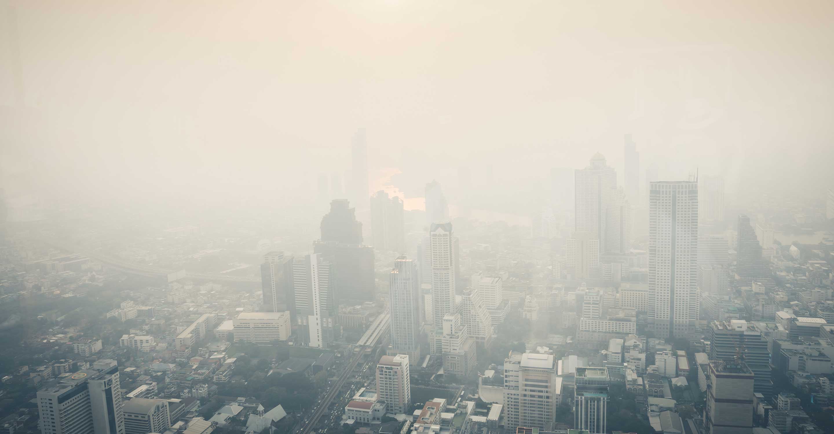
The air quality of Vietnamese cities is declining, in many places, the problem of environmental pollution is already at an alarming level. In big cities, road vehicles are the main cause of air pollution. The amount in urban areas caused by traffic accounts for between 60-70 per cent, in addition, the emission sources include agricultural production activities such as straw burning, mining activities, and construction activities. Emissions from other industries and daily-life activities account for only a relative proportion of emissions causing urban air pollution.
When transporting materials, even if carefully covered, dust will be scattered into the environment and cause pollution. Not to mention, in cases where it is not covered, materials will fall onto the road, causing danger and producing a huge amount of smoke and dust that can hinder vehicles from travelling on the road. Therefore, it is imperative to pay attention to proper shielding and covering when transporting materials.
Air pollution threatens virtually everyone living in the world's major cities, causing 7 million premature deaths each year. It is thought that 80 per cent of cities around the world do not meet World Health Organisation (WHO) standards for clean air quality. Increasing global air pollution levels are leading to an increased risk of stroke, cardiovascular disease, lung cancer, and a host of more serious respiratory problems.
PM2.5 is always mentioned on the air pollution map for Thu Dau Mot, but what is it?
When the concentration of PM2.5 fine dust in the outdoor air increases, it will cause the air to become blurred and the visibility will be reduced to look like fog. PM2.5 fine dust can easily enter the human body through inhalation and cause a number of dangerous diseases such as stroke, heart disease, cancer, etc. People are often exposed to dust. Anybody can succumb to health problems such as sneezing, runny nose, shortness of breath and dry eyes while long-term exposure will increase the rate of decreased lung function, chronic and increased mortality from lung cancer and heart disease in patients. According to statistics, every year, fine dust can increase by 10 microns per cubic metre, which means that the number of emergency patients with high blood pressure will increase by 8 per cent and cardiovascular diseases will also increase significantly.
Stay Informed. Download #1 air quality app
Air pollution forecast, pollution alerts and much more to help you plan your days and keep protected against air pollution


Connect With IQAir
Sign up for our newsletter