



 Add
AddAir quality in Camden South
Air quality index (AQI⁺) and PM2.5 air pollution in Camden South • 6.5K Followers • 14:00, Oct 09 Local time
36*
US AQI⁺Good

Main pollutant:
PM2.5
6.4 µg/m³

26°

11 km/h

29 %
Hourly forecast
Camden South air quality index (AQI⁺) forecast


Daily forecast
Camden South air quality index (AQI⁺) forecast
| Today | 41 | | 27° 8° |  20 km/h | 59% |
| Sat | 33 |  | 31° 15° | 25 km/h | 48% |
| Sun | 44 | | 30° 12° | 24 km/h | 58% |
Air pollutants
What is the current air quality in Camden South?

PM2.5 concentration is currently 1.3 times the World Health Organization annual PM2.5 guideline value.
Health recommendations
 Enjoy outdoor activities |
 Open your windows to bring clean, fresh air indoors Get a monitor |
Pollen
What is the pollen count in Camden South today?
Index

Moderate
 Tree Moderate | 50% |
 Grass Low | 25% |
 Weed None | 0% |
Source:
wetter.comHealth recommendations
Enjoy outdoor activities |
Open your windows to bring clean, fresh air indoors Get a monitor |
Pollen
What is the pollen count in Camden South today?
Index
Moderate
Tree Moderate | 50% |
Grass Low | 25% |
Weed None | 0% |
Source:
wetter.comMost polluted locations near Camden South
Worldwide AQI⁺ ranking
City ranking
Real-time Australia AQI⁺ city ranking

Historic air quality near Camden South
History
Historic air quality graph for Camden South
Historic air quality near Camden South
History
Historic air quality graph for Camden South
Most polluted locations near Camden South
Worldwide AQI⁺ rankingCity ranking
Real-time Australia AQI⁺ city ranking



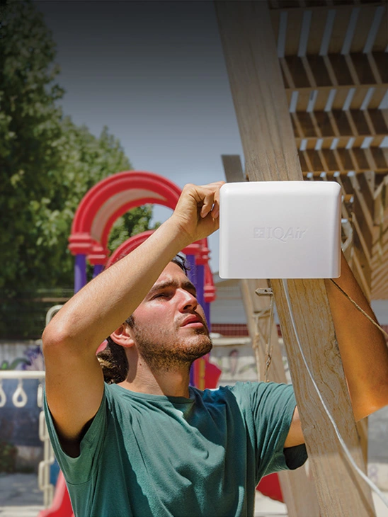
Be the first to measure and contribute air quality data to your community


Learn more about air pollution in Camden South
What is the current air quality in Camden South?
The current air quality in Camden South is considered good. Air pollution levels are low and there are no expected health risks, making it a good time to enjoy normal outdoor activities.
How bad is the air quality in Camden?
Camden is a town and suburb of Sydney in New South Wales, located approximately 65 kilometres south-west of Sydney’s central business district. Camden makes up part of Greater Sydney’s South-west air quality monitoring area, according to the New South Wales government. Like much of Australia, Camden and New South Wales experience relatively health air quality most of the year round, in comparison with global locations. However, Camden is also vulnerable to occasional extreme air pollution events, most frequently caused by wildfires and dust storms, which can significantly elevate air pollution levels temporarily.
The New South Wales government monitors a range of air pollutants across the state, including particulate matter, sulfur dioxide (SO2), nitrogen dioxide (NO2), ozone (O3), carbon monoxide (CO) and visibility, which can act as an indicator for smoke. However, of these, the main pollutants of concern within NSW are particulate matter and ozone. Particulate matter describes microscopic airborne particles measuring less than 2.5 or 10 microns in diameter, abbreviated as PM2.5 or PM10 respectively. These particles can have various chemical makeups, but are particularly harmful to human health due to their tiny size. This enables them to travel deep into the human system upon inhalation, entering the lungs and, in the case of PM2.5, travelling further into the bloodstream, causing a range of health effects. PM and ozone are considered of greatest concern within New South Wales both due to the health hazards posed by these pollutants to populations worldwide, and also because these pollutants most often exceed Australia’s national air quality standards, known as the National Environment Protection (Ambient Air Quality) Measure (Air NEPM) within New South Wales. These standards are established as guideline limits for a range of pollutants across the country, outlining a level that should minimise people’s negative health impacts. Therefore, exceedances by certain pollutants represents some cause for concern.
Real-time air quality information is displayed within the Camden air quality map at the top of this page, which also includes live wildfire updates. These can be accessed on the move using the IQAir AirVisual air pollution app, which also provides a 7-day Camden air quality forecast, to stay prepared for changing conditions.
What are the main sources of air pollution in Camden?
The main sources of particle pollution in New South Wales, including Camden air pollution, include those of emissions from residential wood smoke, coal mining, industry, vehicle exhausts, generation of electricity, and bushfires and planned burns, according to a report from the NSW Government.1
Is Camden affected by the fires in Australia?
Australia has long experienced fires across various parts of the country, with an established fire season. The majority of Australian fires are started through natural causes, such as a stroke of lightning, although fires can also ignite as a consequence of human activity; either accidentally, such as through setting an accidental spark, or deliberately through planned burn activities or arson. However, some fire seasons are worse than others, and during the summer of 2019-2020, Australia experienced one of its worst fire seasons on record. Known as the “black summer”, this was particularly devastating following several months of drought, record-breaking temperatures and low rainfall, which – when combined with strong winds – laid the conditions for fires to thrive. New South Wales was the worst hit overall of any state, suffering 5.5 million hectares of burned land, the destruction of 2,448 homes, and 26 of 33 total lives that were tragically claimed by the fires across Australia were taken in the New South Wales fires.2 Camden did not escape the impacts of these fires, with air pollution levels within the town reported as three times above the government’s “hazardous” threshold in early December 2019, measuring a more severe air pollution reading than in Beijing.3
What are the health impacts of fire smoke in Camden?
The health impacts of exposure to such quantities of wildfire smoke in Australia should not be underestimated. Exposure to particle pollution (which is one major pollutant generated by wildfires) can cause a range of both short- and long-term effects on health. Short-term exposure can result in irritation of eyes, nose and throat, along with aggravation of existing conditions such as asthma, lung inflammation, and negative effects on the cardiovascular system. Long-term exposure to PM can contribute to increased risk of developing diseases such as lung cancer, or chronic obstructive pulmonary disease (COPD), referring to a group of diseases which cause breathing difficulties such as emphysema and chronic bronchitis; this long-term exposure can also contribute to reduced lung function development in children and adults.
A study in the Medical Journal of Australia found that, while 33 lives were tragically claimed as a direct result of the black summer’s fires, the health impacts from fire smoke were far more severe. The smoke is estimated to have caused a further 417 excess deaths, along with 1,124 additional hospitalisations for cardiovascular issues and 2,027 for problems related to the cardiovascular system, as well as 1,305 additional emergency department visits related to asthma.4
What is Camden doing about air pollution?
The New South Wales government is responsible for monitoring air quality across the state, to check whether this achieves Australia’s broader air quality objectives, particularly achieving the Air NEPM standards for various pollutants. If certain sites are found to exceed these standards, the government may take remedial actions to improve air quality where necessary. Accordingly, the NSW government has established a statewide network of government air quality sensors to track air quality year-round. A governmental monitoring station was established in Camden from December 2012, which followed a former industry-operated station functioning there between 1994 – 2004. Having been recommissioned in 2012, the station is situated Camden aerodrome, south of the Hawkesbury basin. It measures a range of pollutants and weather parameters, including PM2.5 and PM10, nitrogen oxides (NO, NO2, NOx), carbon monoxide (CO), visibility, and wind speed and direction.5
Additionally, Camden Council and the New South Wales government both are involved in sharing information and resources to support the implementation of Australia’s wider air quality regulation. For example, Camden Council has supported the NSW government’s objectives by participating in its Wood Smoke Reduction Program at a local level, and as part of initiatives to encourage responsible wood smoke burning and minimise smoky emissions from this, Camden Council also makes ‘moisture meters’ available to loan from its public library. These can be used to check the moisture levels of wood before burning, since burning wet or moist wood causes fires to produce significantly more smoke than burning dry wood.6
Does Camden use an air quality index?
The New South Wales government used to report its statewide monitoring data using an air quality index (AQI), however, this was switched in November 2020 to reporting instead using a system of air quality categories (AQCs).7 Therefore, while previously a Camden air quality index figure (or Camden AQI) would have been reported to the public, now Camden’s air quality measurements are expressed by the government as one of five colour-coded categories. These range from “Good” (green) up to “Extremely poor” (deep red). At sites where multiple pollutants are measured, a category is calculated for each pollutant to indicate its respective level of health risk; then the pollutant with the highest (most hazardous) category will determine that site’s overall category. In this way, the NSW government strives to simplify air quality measurements for several pollutants, into a single, easy-to-understand indicator of health hazard, enabling the public to quickly respond and protect health when needed.
+ Article resources
[1] NSW Government. “Consultation paper: Clean Air for NSW”. NSW Government EPA website, 2016.
[2] Australian Institute for Disaster Resilience. “New South Wales, July 2019 – March 2020. Bushfires – black summer”. Australian Disaster Resilience Knowledge Hub, n.d.
[3] Steven Trask. “NSW bushfire health warning: Air quality rating three time the hazardous level, leaving Sydneysiders choking”. 7 News, December 3, 2019.
[4] Nicolas Borchers Arriagada et al. “Unprecedented smoke-related health burden associated with the 2019-20 bushfires in eastern Australia”. Medical Journal of Australia 213(6): 282-283, August, 2020. doi: 10.5694/mja2.50545
[5] NSW Government’s DPIE. “Camden air quality monitoring station”. NSW Government website, June 1, 2018.
[6] Camden Council. “Wood Smoke Reduction Program”. Camden Council NSW website, n.d.
[7] NSW Government DPIE. “Air quality concentration data – updated hourly”. NSW Government DPIE website, n.d.





