



 Add
AddAir quality in Wollongong
Air quality index (AQI⁺) and PM2.5 air pollution in Wollongong • 1.1M Followers • 11:00, Oct 09 Local time

16
US AQI⁺Good

Main pollutant:
PM10
17.2 µg/m³

19°

11 km/h

54 %
Hourly forecast
Wollongong air quality index (AQI⁺) forecast


Daily forecast
Wollongong air quality index (AQI⁺) forecast
| Today | 44 | | 21° 11° |  30 km/h | 69% |
| Sat | 35 |  | 28° 17° | 21 km/h | 57% |
| Sun | 46 | | 22° 15° | 26 km/h | 76% |
Air pollutants
What is the current air quality in Wollongong?

PM2.5 concentration currently meets the WHO annual PM2.5 guideline.
Health recommendations
 Enjoy outdoor activities |
 Open your windows to bring clean, fresh air indoors Get a monitor |
Pollen
What is the pollen count in Wollongong today?
Index

Low
 Tree Low | 25% |
 Grass Low | 25% |
 Weed None | 0% |
Source:
wetter.comHealth recommendations
Enjoy outdoor activities |
Open your windows to bring clean, fresh air indoors Get a monitor |
Pollen
What is the pollen count in Wollongong today?
Index
Low
Tree Low | 25% |
Grass Low | 25% |
Weed None | 0% |
Source:
wetter.comMost polluted locations near Wollongong
Worldwide AQI⁺ ranking
Station ranking
Real-time AQI⁺ station ranking for stations in Wollongong

City ranking
Real-time Australia AQI⁺ city ranking
Historic air quality near Wollongong
History
Historic air quality graph for Wollongong
Historic air quality near Wollongong
History
Historic air quality graph for Wollongong
Most polluted locations near Wollongong
Worldwide AQI⁺ rankingStation ranking
Real-time AQI⁺ station ranking for stations in Wollongong
City ranking
Real-time Australia AQI⁺ city ranking


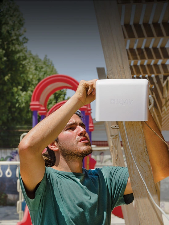
Measure your own air quality
Get a monitor and contribute air quality data in your city.


Learn more about air pollution in Wollongong
What is the current air quality in Wollongong?
The current air quality in Wollongong is considered good. Air pollution levels are low and there are no expected health risks, making it a good time to enjoy normal outdoor activities.
How bad is air quality in Wollongong?
As a coastal city located 68 kilometers south of Sydney in New South Wales, Wollongong air quality is heavily influenced by its geography. As New South Wales’ 3rd most populated city, and the tenth most populated in Australia, year-round air quality in Wollongong is relatively healthy by global standards. However, the city also experiences frequent short-term pollution events that exceed national Australia air quality standards, often as a result of bushfires or dust storms.1
The main pollutants of concern in Wollongong are particulate matter (tiny airborne particles measuring 2.5 and 10 microns in diameter, abbreviated to PM2.5 and PM10 respectively), and ozone. These are the pollutants which most often exceed Australian air quality limits, posing health hazards to Wollongong’s approximately 300,000 residents.1 PM2.5 is widely recognised as one of the most harmful pollutants to human health, both due to its tiny size enabling it to penetrate deep into the human system, and also its prevalence as a pollutant worldwide.2 Even at low levels, exposure to both PM2.5 and ozone pollution can increase people’s risk of lung and heart disease, and aggravate existing conditions, such as asthma.3 Certain parts of the population are more vulnerable to the health effects of Wollongong air pollution, including the elderly, children, and people with pre-existing health conditions.3
During 2019, Wollongong ranked as Australia’s 14th most polluted city for PM2.5 pollution of 95 Australian cities measured in IQAir’s 2019 World Air Quality Report.4 Wollongong air pollution averaged 10.6 μg/m3 PM2.5 concentration, which exceeds both Australia’s annual PM2.5 standard of 8 μg/m3, and the World Health Organisation (WHO)’s annual standard of 10 μg/m3. This ranked Wollongong’s PM2.5 pollution as slightly worse thanSydney air quality in 2019, averaging 10.1 μg/m3, but cleaner thanCanberra air pollution, which averaged 15.0 μg/m3. Wollongong’s 2019 score marked an increase from its previous annual levels of PM2.5, which averaged 7.4 μg/m3 in 2018, and 7.9 μg/m3 during 2017. This increase may partly be linked to the particularly severe wildfires that devastated Australia during the summer months of 2019-2020, during which New South Wales was the worst affected state.5
Live air pollution levels are displayed within the dynamic Wollongong air quality map at the top of this page, which also includes local wildfire alerts. These and a 7-day Wollongong air quality forecast can be followed any time using the IQAir AirVisualair pollution app.
What are the main sources of air pollution in Wollongong?
Together with the city of Shellharbour and town of Kiama, coastal Wollongong is part of the Illawarra region in New South Wales (NSW), which lies south of Sydney and north of NSW’s South Coast region. The Illawarra area’s particular geography has a strong influence on its air quality: while it is surrounded by sea to the east, it is enclosed from the inland west by the Illawarra mountain range. Sea winds therefore influence the transport of air pollution to and from Wollongong, while the mountain range can also limit the dispersion of air pollutants within the region.1
Wollongong air pollution comes from both sources within the city, and transboundary air pollution from external sources. Year-round sources of Wollongong air pollution include industry, household activities and commercial business (of which, residential wood heating accounts for over 90% of particle emissions), road transport, and natural sources such as smoke from bushfires and wind-blown dust.1
Is Wollongong affected by wildfires?
Australia has long experienced annual bushfires during its summer months to some extent. Bushfires can be started naturally, from a lightning strike, or from human actions, accidentally through a human-made spark, or deliberately, through planned burning or arson. However, Australia experienced particularly severe bushfires during the summer of 2019-2020, due to months of record-breaking temperatures and prolonged drought. Colloquially known as Australia’s “black summer”, an estimated 50 million acres of land was burned, including 16 million acres in the south eastern part of the country, while at least 34 people were killed and almost 6,000 homes and buildings destroyed.6 New South Wales was the most severely affected state by the fires, followed by its neighbouring state of Victoria.5 The Illawarra region, including Wollongong experienced some of the hazardous air pollution that was generated through these intense forest fires during January 2020, as the region was surrounded by nearby fires.7
Is Wollongong air quality improving?
Wollongong, like much of Australia, generally experiences better air quality during its winter months when extreme bushfire-related pollution events are less frequent. However, it is likely Wollongong and the NSW area will experience more annual bushfires in the summer months of subsequent years. Due to increasing global temperatures as part of climate change exacerbating the conditions for bushfires, it is predicted that in the long-term, such wildfire events may worsen further over time.6 However, in the near-term, experts suggest that due to the extensive destruction of “fuel” caused by the 2019-2020 fires, in the form of trees and dead plant material, fires during the subsequent 3 to 5 years may not be as severe as these resources recover.8
Aside from bushfires and short-term pollution events, a study by the NSW Government’s Office of Environment and Heritage found that air pollutants aside from particulate matter and ozone have been decreasing over time in the Illawarra region. Carbon monoxide, sulphur dioxide and lead have been found to decrease since the 1990s and consistently achieve the national standards.1
What is Wollongong doing about air pollution?
Wollongong air quality is managed by the New South Wales government’s Department of Planning, Industry and Environment (DPIE), which aims to ensure thatNSW air quality achieves Australia’s broader air quality targets. The NSW DPIE runs an automatic air quality monitoring station in Wollongong which measures ozone (O3), nitrous oxides (NOx), carbon monoxide (CO), sulphur dioxide (SO2), particulate matter, in addition to visibility and weather parameters. Government monitoring is used to measure whether Wollongong air quality is meeting Australia’s national air quality standards. Australia has some of the strictest standards in the world for particulate matter, reflecting its relatively healthy air quality year-round. The national standards, known as the National Environment Protection Measure for Ambient Air Quality (Air NEPM), set an annual limit for PM2.5 of 8 μg/m3, with the aim to update to 7 μg/m3 by 2025; while its daily PM2.5 limit is 25 μg/m3.9 For global contrast, the European Union’s air quality standards for PM2.5 are a more generous 25 μg/m3 annual average, and 50 μg/m3 daily limit.
The NSW Government also uses an index to communicate air quality to the public. A Wollongong air quality index is therefore reported using this system, which represents pollutant levels as a percentage of their respective NEPM standard: for example, a Wollongong AQI of 100 would represent 100% of the maximum allowance of a certain pollutant under the NEPM standards, and 200 would represent a twofold exceedance of that limit. NSW’s color-coded AQI scale goes from 0-33, “Very Good”, up to 200+, “Hazardous”.10 Where multiple pollutants are monitored, the pollutant with the highest AQI level (and corresponding health hazard) will dictate that location’s overall AQI figure.
+ Article resources
[1] NSW Government’s Office of Environment and Heritage. “Air Quality Trends in the Illawarra: Current knowledge based on emission, monitoring and modelling studies, and areas of ongoing research”. NSW Government website, September, 2015.
[2] World Health Organisation. “Ambient (outdoor) air pollution”. WHO website, May 2, 2018.
[3] NSW Government’s Office of Environment and Heritage. “Air Quality in the Illawarra” (Infographic). NSW Government website, n.d.
[4] IQAir. “2019 World Air Quality Report”. IQAir website, March 18, 2020.
[5] BBC. “How did Australia fires start and what is being done? A very simple guide.” BBC website, January 7, 2020.
[6] Henry Fountain. “Climate Change Affected Australia’s Wildfires, Scientists Confirm”. New York Times, March 4, 2020.
[7] Kate McIlwain. “Illawarra air quality ‘hazardous’ for days as bushfires skirt region”. Illawarra Mercury, January 5, 2020.
[8] Kevin Tolhurst. “It’s 12 months since the last bushfire season began, but don’t expect the same this year”. The Conversation, June 10, 2020.
[9] Australian Government. “National air quality standards: Ambient air quality (2016)”. Australia Government State of the Environment website, 2016.
[10] NSW Government. “Air Quality Index (AQI) and activity guide”. NSW Government website, January 9, 2020.





