
Air quality near Ealing John Perryn Primary School, London
Air quality index (AQI⁺) and PM2.5 air pollution near Ealing John Perryn Primary School, Hammersmith, London • 66 Followers • 22:00, Jun 25 Local time
54
US AQI⁺Moderate

Main pollutant:
PM2.5
10.9 µg/m³
23°
10 km/h
81 %
Hourly forecast
Ealing John Perryn Primary School, London air quality index (AQI⁺) forecast
Daily forecast
Ealing John Perryn Primary School, London air quality index (AQI⁺) forecast
| Today | 53 | 35° 23° | 17 km/h | 43% | |
| Sat | 55 | 29° 21° | 15 km/h | 56% | |
| Sun | 50 | 24° 18° | 16 km/h | 60% |
Air pollutants
What is the current air quality near Ealing John Perryn Primary School?
PM2.5 concentration is currently 2.2 times the World Health Organization annual PM2.5 guideline value.
Health recommendations
Sensitive groups should reduce outdoor exercise |
Close your windows to avoid dirty outdoor air Get a monitor |
Sensitive groups should wear a mask outdoors Get a mask |
Sensitive groups should run an air purifier Discover Atem car |
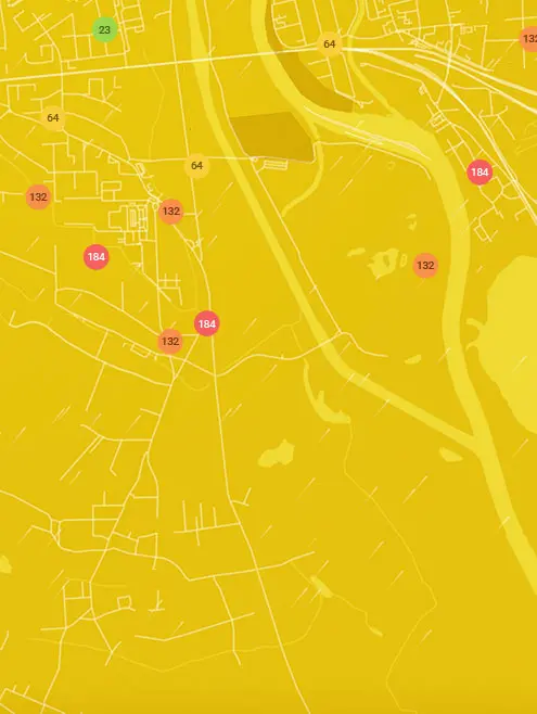
Real-time Ealing John Perryn Primary School, London air pollution map
Pollen
What is the pollen count in Ealing John Perryn Primary School today?
Index

High
Tree Low | 25% |
Grass High | 75% |
Weed None | 0% |
Source:
Open-Meteo.comPollen
What is the pollen count in Ealing John Perryn Primary School today?
Index
High
Tree Low | 25% |
Grass High | 75% |
Weed None | 0% |
Source:
Open-Meteo.comHistoric air quality near Ealing John Perryn Primary School
History
Historic air quality graph for Ealing John Perryn Primary School
Measure your own air quality
Get a monitor and contribute air quality data in your city.
Most polluted locations near Ealing John Perryn Primary School, London
Worldwide AQI⁺ rankingStation ranking
Real-time Ealing John Perryn Primary School AQI⁺ station ranking
Get comprehensive data about air quality in Ealing John Perryn Primary School, London


Download our Air Quality App
Learn more about global air quality


Where is the cleanest air quality in London?
- London Marylebone Road39
- Tally Ho39
- London Honor Oak Park43
- Guildhall47
- Lynton Road52
- Ealing John Perryn Primary School54
- John Harrison Way55
- LARA-east55
- Offord Road Green Alliance55
- Donald Road56
- Hounslow Heston56
- South Circular Road57
- A1203 - Shadwell58
- Ashmead School, SE858
- Harlesden High Street58
- N6 6NA 258
- Scotch House Corner - Westminster58
- Stamford Street58
- Victoria Park Harriers58
- Warwick Road58
- Haringey Wood Green59
- 1-8 Dukes Point60
- ICWCS60
- Columbia Road Primary School60
- Concert Hall Approach60
- Connaught Village60
- Cromwell Road60
- Porchester Road60
- Royal Street60
- Science Museum60
- Sloane Square60
- Waterloo Road60
- Wentworth St60
- Weymouth Avenue - Little Ealing Lane60
- Wren Close60
- HF 7 - Riverwalk61
- London Haringey Priory Park South61
- Newham61
- Barnes Wetlands62
- Cricklewood Lane62
- Elsley Primary School62
- Elthorne Park & Leighton Roads Residents Association62
- Gunthorpe St62
- Hackney Amhurst Road62
- Hackney New Primary School62
- London Bloomsbury62
- Oakley St62
- Rosemead Preparatory School & Nursery62
- Sloane Street62
- Sunny Hill, Hendon62
- Upper Ground62
- Willesden High Street62
- London N. Kensington63
- Tower Bridge Road63
- The Aldgate School63
- Hackney Homerton Library64
- Imperial War Museum64
- LARA West64
- Linden Children's Centre64
- Waltham Forest Dawlish Rd64
- Whitfield Nursery Playground64
- Ealing Acton Background65
- Falconwood65
- London Teddington Bushy Park65
- Bowes Primary School66
- Cam Road66
- Hackney Old Street66
- Hammersmith Town Centre66
- Highgate West Hill Resident66
- Imperial College White City - Scale Space66
- Lancaster West RA66
- Myatt’s Fields Park66
- Wormwood Scrubs67
- A206 Burrage Grove68
- Air on the Green68
- Blackheath68
- Camden Kerbside68
- Falcon Building, Bloomsbury68
- Fiveways Sidcup Rd A2068
- Green Westbourne68
- Kew Gardens68
- London Westminster68
- Mary Immaculate and St. Peter's Church68
- National Gallery68
- Plumstead High Street68
- Southwark Elephant and Castle68
- St Francis of Assisi68
- Waltham Forest Leyton68
- Wellington Square68
- Altab Ali Park69
- Coopers Lane69
- Earls Court Road69
- Greenwich Woolwich Flyover69
- Old Farm Ave Allotment69
- Serpentine Gallery69
- Shepherds Bush69
- St Matthew's Road, Brixton69
- Westhorne Avenue (reference co-location)69
- Barking Food Forest71
- London Barnet Chalgrove School71
- N6 6NA71
- Regent Street (The Crown Estate)71
- Tower Hamlets Roadside71
- Hackney Dalston Lane73
- London Farringdon Street73
- Northumberland Place73
- Waterloo Place (The Crown Estate)73
- Euston Road74
- Brent Ikea (reference co-location)75
- Tooting High Street75
- Belvedere77
- HF 9 - Sands End79
- Southwark A2 Old Kent Road81
- Lavender Hill (Clapham Jct)102


