
Seattle air quality map
Live air pollution map of Seattle • 739.7K Followers • 12:00, Jul 17


Stations
Clean Air Facilities
Contributors
Government
2Diplomatic
0Non-profit
1Education
0Corporate
0Healthcare
1Hospitality
0Individual
169Top contributors in Seattle
Who is sharing outdoor air quality data in Seattle?
Featured station
Discover some of the best station installation in Seattle


Station gallery

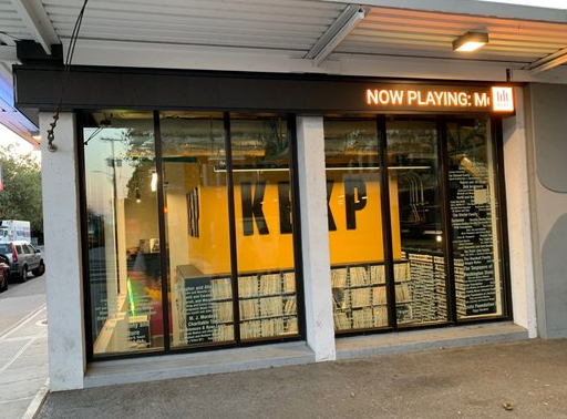
Candy Cane Lane, Seattle
17
Newest stations deployed in Seattle
AQI⁺ station rankingNewest stations

Clean Air Facilities


Learn more about global air quality


Learn more about air pollution in Seattle
How is Seattle air quality?
Seattle has mixed air pollution ratings. Despite “good” US AQI levels over recent years, Seattle failed to meet federal targets for allowable unhealthy ozone days and unhealthy PM2.5 days in 2019.
On average, Seattle experiences 14.2 unhealthy pollution days a year, with 7 owing to high ozone and 7.2 owing to high PM2.5.1 The US Environmental Protection Agency (EPA) recommends no more than 3.2 unhealthy pollution days each year for each pollutant. The frequency of Seattle’s pollution spikes is thereby more than double the targeted allowance.
From a broader perspective, the 14.2 unhealthy pollution days represent just 4 percent of the year. Other days in Seattle tend to achieve “good” to “moderate” US AQI ratings. More concerning is a trend of recently declining air quality in King county, of which Seattle is the county seat.
Since 2016, all key measures for PM2.5 and ozone pollution have been on the rise. Prior to the 2015 to 2017 monitoring period, Seattle had met federal attainment levels for the allowable number of “unhealthy” PM2.5 and ozone days. Driving Seattle’s declining air quality is a combination of population growth, new industry and construction, the increased frequency and severity of wildfires, and EPA rollbacks on a variety of emission sources.
A growing population and economy does not need to be a reason for more emissions, however. Shifting towards cleaner energy and more fuel-efficient and low-emission vehicles, clearing forest underbrush with prescribed fires, and further advancing limits on emission sources are all means that have the potential to again reduce Seattle air pollution levels within federal attainment levels.
When will the air quality improve in Seattle?
Seattle air quality is the total of constant daily emissions, weather patterns, and pollution events. While these conditions are not all controllable, healthy air quality levels can be attained by managing what is controllable.
The emphasis of mitigation efforts should be on reducing Seattle emissions from mobile sources like cars and trucks. These sources are responsible for nearly half of Seattle’s air pollution emissions. The advent and popularity of electric vehicles along with government incentives have already reduced some barriers to adaptation. Seattle aims to reach an electric vehicle market share of 30 percent for privately owned electric vehicles by 2030.2 This adoption goal is dependent on individual consumers, however, and may take longer than the proposed timeline.
King County, meanwhile, is moving ahead with plans to adopt an all-electric fleet of 1,400 buses by 2040 as well as converting its ferry fleet to electric vessels. Heavy duty vehicles, such as those powered by diesel, are heavy polluters. The Port of Seattle’s Clean Truck program is working to increase truck carry loads to make these a more viable and accepted option.
Pollution levels are subject to change based on a combination of conditions. Follow Seattle’s changing air quality levels in real time at the top of this page.
Seattle’s forecast air quality data is the best resource for understanding short-term trends in air quality. Plan outdoor activities for times when air quality is in the US AQI “good” category.
Why does Seattle have particulate matter in the air?
In 2019, Seattle air quality averaged an annual PM2.5 concentration of 7.5 μg/m3, meeting both the Environmental Protection Agency (EPA) and World Health Organization (WHO) standards for annual PM2.5 exposure. While success in meeting these annual targets reduces the health risk of Seattle residents, the WHO cautions that no level of PM2.5 exposure has been shown to be free of health impacts.3
Seattle PM2.5 pollution is often attributed to the large concentration of industrial facilities and seafaring ships in South Park and Georgetown.4 It may come as a surprise that a majority of emissions, instead, originate from the city’s motor vehicles. Heavy duty trucks and other diesel engines are especially culpable.
The residents of Georgetown and South Park are all too familiar with smoke from freight trucks hauling cargo from the port to rail yards. On an average weekday, over 8,000 commutes are taken by freight trucks. The impact of this hyperlocal emission source is severe.
A 2008 study by Puget Sound’s Clean Air Agency found that these areas in the Duwamish Valley experience an extra 400 cancer cases per 100,000 people. For residents who live near major roadways, the situation is even more severe, with an additional 40 to 80 cancer cases per 100,000 people. (The study assumed 70 years of exposure as well as the worst-case scenario of exposure.)
Seasonal trends, including wildfires in the late summer and fall and wood burning in the winter, contribute to Seattle’s highest PM2.5 levels. While August was the most polluted month in 2017 and 2018 as a result of wildfires, elevated PM2.5 levels throughout the winter months tended to be roughly 40 percent higher than in the summer months.
Identify active wildfires burning in the King County area with Seattle air quality map, which pinpoints fire locations and illustrates the flow of particle pollution in real-time.
Where does Seattle rank in US cities for air quality?
Seattle’s air quality index (AQI) consistently averages ratings categorized as “good.” The city misses the mark, however, when it comes to its number of unhealthy pollution days, or 24-hour spikes.
The American Lung Association (ALA) releases an annual air quality report card showing comparative pollution levels across US regions and counties. According to the 2020 report card, Seattle received an “F” grade for both 24-hour PM2.5 and ozone.
Seattle’s failing grade was a result of exceeding the allowable target of 3.2 unhealthy ozone days and 3.2 unhealthy PM2.5 days. From 2016 to 2018, Seattle experienced an average of 7 high ozone days and 7.2 high PM2.5 days.
By these measures, Seattle ranks 36th nationally for high ozone days out of 229 included metropolitan areas and ties for 14th for worst 24-hour particle pollution out of 216 metropolitan areas. Seattle, Spokane, WA, and Coeur d'Alene, ID area tied for 14th worst particle pollution, experienced similar elevated PM2.5 levels as a result of wildfires.
What is Seattle doing to improve air quality?
In order to further drive air quality improvements in the future and meet federal attainment levels for 24-hour PM2.5 and ozone pollution, Seattle air quality policies must be multifaceted.
The city’s growing population will add new construction, increase strain on Seattle's infrastructure, and increase the toll of residential daily emissions. Climate change will present another challenge – warming temperatures increase the rate at which ozone forms and create a longer ozone season. Such conditions may likely counter Seattle air pollution measures intended to reduce the prevalence of precursor pollutants in the air.
Against this backdrop, Seattle is federally required to address its non-attainment pollution levels. Ongoing air quality mitigation efforts in Seattle include:
- Reducing solid waste emissions by capturing waste gas to burn as energy rather than flaring it into the air.5
- Employing a clean diesel program to shift heavy duty trucks to ultra-low sulfur diesel fuel, greatly reducing the number of particulates released (began in 2001).
- Replacing 200 aging buses with articulated electric hybrid buses. This project began in 2002 and is expected to decrease fuel consumption by up to 40 percent.
- Changing Seattle’s energy purchasing to ‘no net greenhouse gases’ by using renewable energy.
- Providing incentives for transitioning the general public to electric vehicles, including an established city-wide network of fueling stations, no sales tax, and tax credits to income taxes.6
+ Article Resources
[1] American Lung Association. (2020). State of the air – 2020.
[2] Scruggs G. (2019, September 28). Seattle City Light unveils strategy to handle expected surge in electric vehicles. Geek Wire.
[3] World Health Organization. (2020). Air quality guidelines – global update 2005.
[4] McClure R, et al. (2011, June 13). Breathing uneasy: Air pollution crisis in South Seattle. Investigate West.
[5] King County Government. (2002). Greenhouse gases & traditional pollutant emissions inventory – year 2000.
[6] Seattle Electric Vehicle Association (SEVA). (2020). Things to know when you purchase, lease or convert an Electric Vehicle in Washington State.
Where is the cleanest air quality in Seattle?
- 70th Street Roof1
- Phoenix Moorage1
- South Park near Concord Elementary1
- Wedgwood, Seattle1
- 201 Elliott Ave W2
- 715 25th Avenue South2
- Mid Ballard2
- Seattle Duwamish #13
- 2nd Avenue North6
- Holden House Outside7
- Seattle-10th & Weller8
- East McGraw Street9
- Jon & Leskas9
- 30th Ave NE & NE 91st St10
- 19th Ave NW and NW 97th St11
- 25th Avenue, Central District11
- 27th Ave W11
- 55th Ave S11
- Alaska Junction QFC11
- Dayton Valley11
- Fauntleroy11
- Greenwood & 125th11
- Happy Garden11
- Madison St E11
- Madrona Tree11
- Magnolia Way11
- Nok's place11
- Northeast 123rd Street11
- Orchard & Seward11
- SCH Grounds Department11
- SW Othello Street11
- Windermere11
- Carkeek retreat12
- Salmon Bay Park12
- holmdell12
- 1715 East Roy Street13
- Alaska Junction13
- Kubota Village13
- South Adams Street13
- Thackeray13
- 23rd Avenue Northwest14
- 26th Avenue South14
- 44th Avenue Northeast14
- Capitol Hill station14
- NW 73rd Street14
- North Beacon Hill, Seattle, WA, USA14
- Northwest 134th Street14
- SE Green Lake, Seattle WA14
- Seattle-23rd Ave SW14
- Seattle-College Way N14
- Seattle-S Myrtle St14
- Warren Avenue North14
- 26th & Mercer15
- KCIA_North15
- Seattle-Linden Ave N15
- South Park15
- University Park15
- 48th Ave S16
- Ballard Community Park16
- East Newton Outside16
- Koi Apartments16
- Nick16
- Seattle-13th Ave S16
- Seattle-16th Ave S16
- Southeast Magnolia16
- 23rd and Bayview17
- 28th Avenue Northwest17
- 300 Block 18th Ave E17
- 4420 South Eddy Street17
- 6611 57th Ave NE17
- 6720 18th Avenue NW17
- 9400 California Ave SW17
- Bech Drive Soutwest17
- Bitter Lake Manor17
- Candy Cane Lane17
- Carlton Park17
- Crown Hill17
- Fairmount Park17
- High Point17
- LittleBrook017
- North 65th Street17
- NorthBeach17
- Seattle - 8th Ave W and W Blaine St17
- Seattle-14th Ave S17
- Upper Fremont station17
- View Ridge17
- View Ridge 217
- WPZ West Entry17
- 19th Ave NE18
- 2301-2349 Hughes Ave SW18
- 3441-3491 S Norfolk St18
- 4525 Thackeray Pl NE18
- 6498-5908 NE 61st St18
- 9811518
- FBI Surveillance Van18
- Fairview Ave E18
- Green Lake Southeast18
- Loyal Heights18
- NW 75th and Dibble18
- Seattle-NE 127th S18
- 1099-901 17th Ave E19
- 1939 3rd Avenue West19
- 2011 EastJefferson Street19
- 2947-2975 Alki Ave SW19
- 36th Avenue Outside19
- 40th & Fauntleroy19
- 4211 Woodlawn Ave N19
- 598-500 N 145th St19
- Ballard 319
- Bryant Center19
- Chez Weblard19
- Haller Lake19
- Land’s End, Magnolia, Seattle19
- Magnolia19
- Meadowbrook19
- North 43rd Street19
- Seattle-5th Ave S19
- 16th Avenue20
- 4601 S Roxbury Street20
- 497-403 Belmont Ave E20
- 781 26th Ave East20
- Awesome NW 6420
- Ballard 58th and 26th AVE20
- East Queen Anne20
- Gatewood20
- Magnolia Blvd W & W Parkmont Pl20
- Stevens20
- 13525 32nd Ave NE21
- 1st Avenue Northwest21
- 5700-5998 30th Ave NE21
- 759-925 N 95th St21
- 8251-8201 43rd Ave NE21
- Adams21
- Capitol Hill 221
- Cedar Park, Seattle, WA21
- Columbia City21
- Corliss Avenue North21
- Duwamish21
- Lawton Park21
- Maiden Lane East21
- North Queen Anne21
- Northeast 65th Street21
- Puget Ridge Edible Park21
- Seattle - Greenwood21
- St. Clement's Episcopal Church21
- Villa Academy21
- Ziggy's Palace21
- 14th and Howell22
- 1786-1700 26th Ave S22
- Bagley22
- Capitol Hill22
- Clay Street22
- Downtown Seattle Seattle Chinatown District Interstate 522
- Downtown Virginia & 3rd22
- Greater Duwamish22
- Kilbourne Division22
- Phinney Ridge Pea Patch22
- Rainier Valley 222
- SP House22
- SWAC22
- Sunset Hill South22
- Ursula Judkins Viewpoint22
- Wallingford22
- Aviation Heights23
- Glen Dona Apartments23
- Insignia-Outside-8**s23
- Lakeside Upper School23
- Maple Leaf 123
- N 145th and Corliss L&L&L23
- Northgate23
- South Ferdinand Street23
- Seattle-Beacon Hill24
- St. Cloud24
- Viretta25
- Crown Hill - Seattle26
- Minor Avenue26
- 12340-12432 24th Ave NE27
- 4038 NE 104th St27
- Seattle-South Park27
- Cowen Park28
- Maple Leaf30
- 80th in Greenwood33
- W Olympic Pl, Seattle39


