
Air quality near NWCAA - MBSA - Pan Hut, Whatcom County
Air quality index (AQI⁺) and PM2.5 air pollution near NWCAA - MBSA - Pan Hut, Whatcom County • 811 Followers
Data source: PurpleAir
1
US AQI⁺Good

Main pollutant:
PM2.5
0.2 µg/m³
5°
5 km/h
92 %
Data source: PurpleAir
Hourly forecast
NWCAA - MBSA - Pan Hut, Whatcom County air quality index (AQI⁺) forecast
Daily forecast
NWCAA - MBSA - Pan Hut, Whatcom County air quality index (AQI⁺) forecast
| Today | 12 | 8° 4° | 12 km/h | 86% | |
| Sun | 29 | 10° 4° | 13 km/h | 89% | |
| Mon | 38 | 9° 5° | 5 km/h | 89% |
Air pollutants
What is the current air quality near NWCAA - MBSA - Pan Hut?
PM2.5 concentration currently meets the WHO annual PM2.5 guideline.
Health recommendations
Enjoy outdoor activities |
Open your windows to bring clean, fresh air indoors Get a monitor |
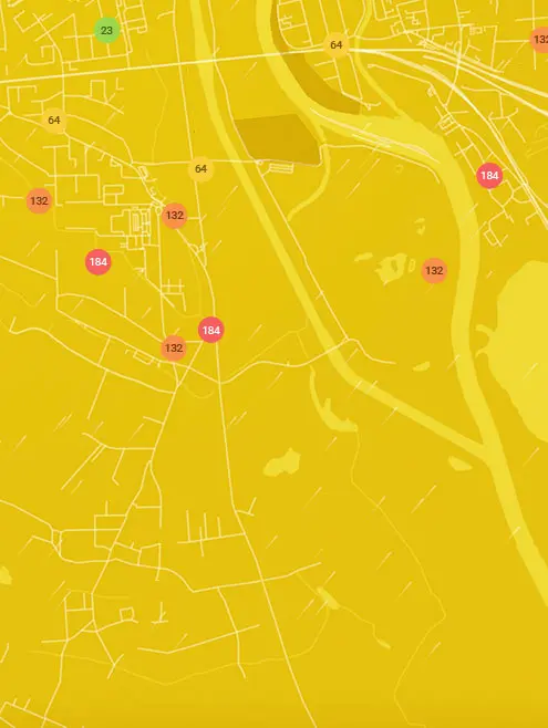
Real-time NWCAA - MBSA - Pan Hut, Whatcom County air pollution map
Pollen
What is the pollen count in NWCAA - MBSA - Pan Hut today?
Index

Moderate
Tree None | 0% |
Grass Low | 25% |
Weed Moderate | 50% |
Source:
wetter.comPollen
What is the pollen count in NWCAA - MBSA - Pan Hut today?
Index
Moderate
Tree None | 0% |
Grass Low | 25% |
Weed Moderate | 50% |
Source:
wetter.comHistoric air quality near NWCAA - MBSA - Pan Hut
History
Historic air quality graph for NWCAA - MBSA - Pan Hut
Measure your own air quality
Get a monitor and contribute air quality data in your city.
Most polluted locations near NWCAA - MBSA - Pan Hut, Whatcom County
Worldwide AQI⁺ rankingStation ranking
Real-time NWCAA - MBSA - Pan Hut AQI⁺ station ranking
Get comprehensive data about air quality in NWCAA - MBSA - Pan Hut, Whatcom County


Download our Air Quality App
Learn more about global air quality


Where is the cleanest air quality in Whatcom County?
- Diablo Helipad0
- North Springfield Court0
- Sand Road0
- West Laurel Road1
- 2818-2890 Stein Hill Ln2
- 4962-5098 Patton Rd2
- East Hemmi Road2
- Hillspring Road2
- Custer School Road3
- Newhalem Street3
- North Cascades Environmental Learning Center3
- 5018-5056 Wahl Rd4
- East Badger Road-NWCAA - Nooksack Valley High School4
- Matia View Drive4
- Nulle Woods Court5
- Island View6
- Mayne Lane 26
- Loomis Trail Road station7
- Custer-Loomis22
- Chuckanut Point Road27


