

Hourly forecast
Linden Hills, Minneapolis air quality index (AQI⁺) forecast
Daily forecast
|
Linden Hills, Minneapolis air quality index (AQI⁺) forecast
| Today | 24 | 25° 12° | 30 km/h | 50% | |
| Tue | 12 | 22° 13° | 24 km/h | 48% | |
| Wed | 11 | 17° 12° | 20 km/h | 84% |
Air pollutants
What is the current air quality near Linden Hills?
PM2.5 concentration currently meets the WHO annual PM2.5 guideline.
Health recommendations
Enjoy outdoor activities |
Open your windows to bring clean, fresh air indoors Get a monitor |
Real-time Linden Hills, Minneapolis air pollution map
Pollen
What is the pollen count in Linden Hills today?
Index

Moderate
Tree Low | 25% |
Grass Moderate | 50% |
Weed Moderate | 50% |
Source:
wetter.comPollen
What is the pollen count in Linden Hills today?
Index
Moderate
Tree Low | 25% |
Grass Moderate | 50% |
Weed Moderate | 50% |
Source:
wetter.comHistoric air quality near Linden Hills
History
Historic air quality graph for Linden Hills
27 AQI⁺ US
Good
13:00–14:00 Jun 15 Local time
AQI⁺ US
Measure your own air quality
Get a monitor and contribute air quality data in your city.
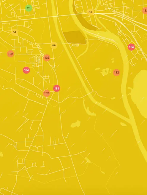
Most polluted locations near Linden Hills, Minneapolis
Worldwide AQI⁺ rankingStation ranking
Real-time Linden Hills AQI⁺ station ranking
Get comprehensive data about air quality in Linden Hills, Minneapolis


Download our Air Quality App
Learn more about global air quality


Where is the cleanest air quality in Minneapolis?
- East Isles6
- Elliot Park6
- Minneapolis - Anders16
- Minneapolis - East P16
- Minneapolis - Near R17
- Minneapolis - Pacifi18
- Minneapolis - Lowry 19
- 1800-1820 Franklin Ave SE20
- 2nd St NE & 23rd Ave NE20
- Bancroft20
- Minnehaha20
- 2199-2183 Douglas Ave21
- 2399-2305 Irving Ave S21
- 5100-5198 16th Ave S21
- City of Minneapolis Community Air Monitoring Project 921
- City of Minneapolis community air monitoring project 3321
- 1026-1032 27th Ave SE22
- 2522 County Rd 2322
- 2798-2700 E 22nd St22
- 46th St E & 3rd Ave S22
- 98-70 8th Ave NE22
- Harrison22
- Seward-Franklin22
- 104 E 56th St23
- 12 E 55th St23
- 1216-1294 Lakeview Ave S23
- 1264-1322 23rd Ave NE23
- 1299-1251 N 29th Ave23
- 1299-1251 W 27th St23
- 12th Avenue23
- 164-198 1st Ave NE23
- 1699-1601 10th Ave S23
- 1801-1809 E 27th St23
- 2193-2197 E 58th St23
- 2301-2343 E 41st St23
- 2600-2698 36th Ave N23
- 2650-2698 N 16th Ave23
- 3100-3198 29th Ave S23
- 3699-3651 W 53rd St23
- 3758 Emerson Ave N23
- 462-440 Central Ave W23
- 4928 38th Ave S23
- 5050-5086 47th Ave S23
- 5159 N Humboldt Ave23
- 5399-5301 Pleasant Ave23
- 910-900 E 32nd St23
- City of Minneapolis Community Air Monitoring Project 1923
- City of Minneapolis Community Air Monitoring Project 2023
- City of Minneapolis Community Air Monitoring Project 723
- City of Minneapolis Community Air Monitoring Project 823
- Logan Park23
- Logan Park 223
- W Minnehaha Pkwy23
- 26th Ave NE24
- 3301-3345 E 36th St24
- 36ish & Hiawatha24
- 610 W 29th St24
- Chowen Triangle Station24
- City of Minneapolis Community Air Monitoring Project 7724
- I-35W at Mississippi River24
- NE 36th Ave24
- 4858 Dupont Ave N25
- Columbia Park (Backyard)25
- 1500 7th St. S26
- 241-223 St Albans St N26
- 3501-3507 E 45th St26
- City of Minneapolis Community Air Monitoring Project 1426
- Linden Hills27
- 1211-1153 29th Ave NE28
- Ventura Village28
- 550-598 W 27th St36
- 699-649 W 41st St36
- City of Minneapolis Community Air Monitoring Project 1239


